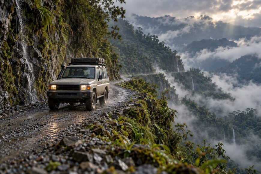
Videos of Bolivia’s Death Road make the drive look dramatic yet manageable. From the driver’s seat, the old Yungas Road is a narrow, changing mountain track where visibility, brake temperature, loose edges, and opposing traffic matter more than the badge on the hood. A bend that looks harmless on a clear screen can become a blind, muddy passage within minutes.
A Toyota Land Cruiser is a capable tool for this terrain. Its four-wheel-drive traction, high clearance, low-range gearing, and durable suspension provide useful margins on rough ground. Its weight also increases the loads on the brakes and tires, so the vehicle helps only when it is properly prepared and driven by someone comfortable with steep, narrow mountain roads.
A professionally managed tour generally brings vehicle preparation, route knowledge, and communication with other drivers. A private drive can be reasonable only with the same discipline. An inadequately prepared Land Cruiser turns a difficult route into a decision with little room for recovery.
- What Bolivia’s Death Road Actually Is
- Why a Land Cruiser Helps—and Where It Does Not
- Managing the Descent: Brakes, Altitude, and Control
- The Hazards Videos Usually Hide
- Preparing the Vehicle and the Drive
- Reading the Road and Sharing It with Other Drivers
- Myths That Make the Drive More Dangerous
- Frequently asked questions
- Why do passengers often feel sick on a Land Cruiser tour?
- What is the deadliest road in the world?
- How long is the Bolivia Death Road?
- What is the Yungas Road in Bolivia?
What Bolivia’s Death Road Actually Is
Yungas Road is a historic mountain route running approximately 64 km from the La Paz area toward Coroico. The old route is commonly called Bolivia’s Death Road because of its history of serious crashes and high accident risk. That nickname describes its reputation; it is not a universally verified official ranking of the world’s deadliest road.
The route drops from approximately 4700 m near its La Paz-area start toward approximately 1200 m near Coroico. This change compresses several driving environments into one journey: cold, exposed highland conditions give way to warmer subtropical vegetation, while the road surface changes between asphalt, dirt, and gravel.
A newer main route opened in 2006 and now carries the principal traffic between the region’s settlements. The old road is used mainly for tourist bicycle and 4×4 tours rather than regular transport, although local conditions and operator practices still determine what traffic a driver may encounter.
Its historic name can encourage the wrong mindset. The road is neither a staged attraction nor a certified contest for danger. It is a demanding mountain route where a heavy vehicle, poor visibility, a wet edge, or a small driving error can quickly reduce the available options.
Why a Land Cruiser Helps—and Where It Does Not
Professional tours commonly use prepared 4×4 vehicles with high ground clearance because the old route can include ruts, loose rock, muddy cuts, and abrupt surface changes. A Land Cruiser’s traction helps maintain controlled movement on uneven ground, while low-range gearing allows the driver to manage steep sections with less dependence on the brake pedal.
Durable suspension is useful when the road becomes rough, but suspension strength does not create grip on wet clay or stabilize a tire running close to a loose edge. Four-wheel drive can distribute traction more effectively; it cannot turn an unstable surface into a reliable one. Tire condition, pressure, steering response, and driver judgment remain decisive.
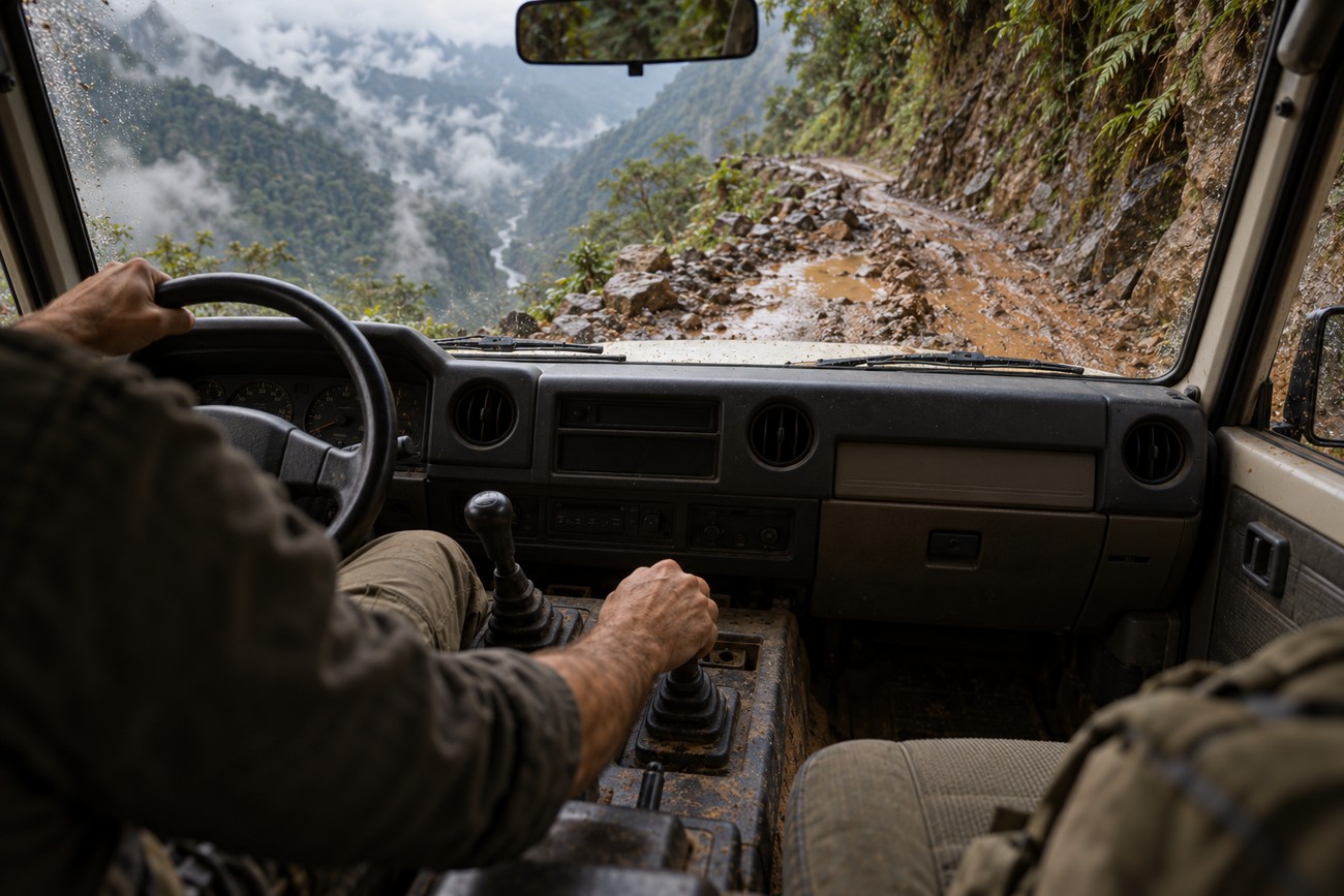
The Land Cruiser’s size also affects visibility. A high seating position may help you see over some obstacles, while the hood, windshield pillars, and door mirrors can make the road edge harder to judge near a blind bend. The vehicle’s weight increases braking and tire loads throughout a long descent, especially when passengers and equipment are aboard.
No vehicle badge compensates for poor tires, defective brakes, bad weather, or an inexperienced driver. A well-prepared Land Cruiser offers useful mechanical reserves; it does not remove the need to turn around, wait, or cancel when conditions exceed those reserves.
Managing the Descent: Brakes, Altitude, and Control
The route falls from approximately 4700 m to approximately 1200 m, and the high starting elevation affects both the vehicle and the driver. Reduced air density can reduce engine performance, particularly in a naturally aspirated vehicle or one already carrying a full load. The driver may also fatigue sooner, making visual judgment and smooth control harder to maintain.
Select the appropriate low range and lower gear before the descent becomes steep. Engine braking should provide the primary control of speed, with the service brakes used for measured corrections and stopping. Selecting a lower gear late, after the vehicle has already gathered momentum, can create a sudden change in traction or control.
Continuous pedal braking converts motion into heat. On a long downhill section, that heat can produce brake fade, brake smell, and a soft or wandering pedal. Those symptoms require a safe place to stop and assess the vehicle; continuing downhill while hoping the brakes recover is a poor plan.
Use smooth inputs and preserve space ahead for correction. Sudden braking, abrupt steering, and rapid gear changes are especially unhelpful on gravel or wet rock, where the available grip may change between the inside and outside wheels. The goal is controlled momentum, not a particular speed.
Altitude also changes the rhythm of the trip. A driver who begins tired, dehydrated, or distracted has less capacity for the repeated concentration required by blind turns and passing decisions. Build pauses into the drive and treat fatigue as a vehicle-control issue, not merely an inconvenience.
The Hazards Videos Usually Hide
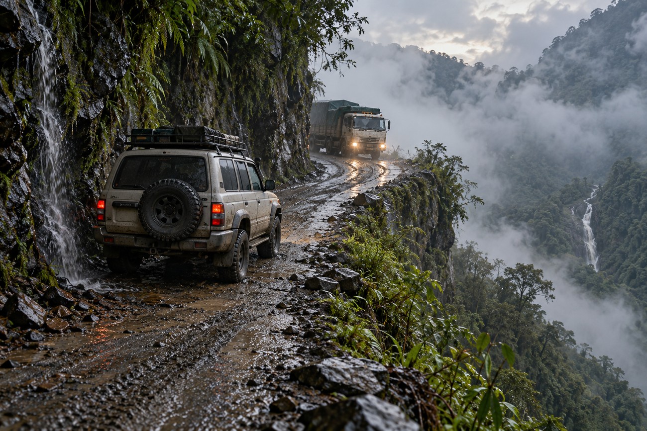
Some sections are so narrow that one vehicle can pass only with difficulty. Formal passing space is often absent, and a blind encounter with a bus, truck, bicycle group, or another tour vehicle can stop the route entirely. The safest response is to reduce uncertainty before entering the bend, rather than relying on a late correction near the edge.
Fog can appear within minutes and sharply reduce visibility. It may hide the outside edge, approaching traffic, water running across the surface, and loose material deposited by a previous vehicle. Headlights, clean glass, and a slower visual scan help, but they do not justify continuing when the road cannot be read reliably.
Waterfalls and wet rock introduce hazards above and below the vehicle. Water may cross the track, wash fine material onto the driving line, or make a previously firm edge soft. Loose rock can fall from the slope, while dust from another vehicle can cover the windshield and mirrors before the driver has time to find a wider section.
The surface combines asphalt with dirt and gravel, and grip can change sharply between them. Rain can produce slippery clay, muddy cuts, wet rocks, and localized landslide conditions. A section that was dry during the morning may become difficult later after rain, runoff, or the passage of heavy vehicles.
That rapid change explains why photographs are poor evidence of current difficulty. The same bend can offer firm gravel, a polished muddy line, and a broken edge within a short period. Read the surface immediately ahead, keep the tires away from unsupported margins, and leave room to stop before the next blind feature.
Preparing the Vehicle and the Drive
Begin with the fundamentals: functioning brakes, suitable tires with sound sidewalls, secure wheels, and a usable spare tire. Check the jack, wheel-changing equipment, recovery points, and basic tools before leaving the paved route. A four-wheel-drive system is useful only if its controls engage correctly and the driver knows how to use them.
Clean the windshield, mirrors, lights, and any cameras before departure, then expect to clean them again. Dust, mud, spray, and stones can quickly obscure the view. Cameras are an aid rather than a substitute for direct observation, especially where their lenses collect grit or water.
Departure timing affects exposure to fog, rain, and opposing traffic. Confirm current conditions with the tour operator or a reliable local source, and treat any operator-specific night limit or convoy procedure as conditional rather than as one universal official rule. A change in weather can matter more than an earlier plan.
Driver experience on narrow mountain roads matters as much as 4×4 capability. The driver should be comfortable with low-range control, engine braking, reversing on a slope, and stopping before a blind corner. Passengers may experience motion sickness from repeated switchbacks, braking, vibration, and the large altitude change, so secure loose items, carry water, and allow time for breaks.
Reading the Road and Sharing It with Other Drivers
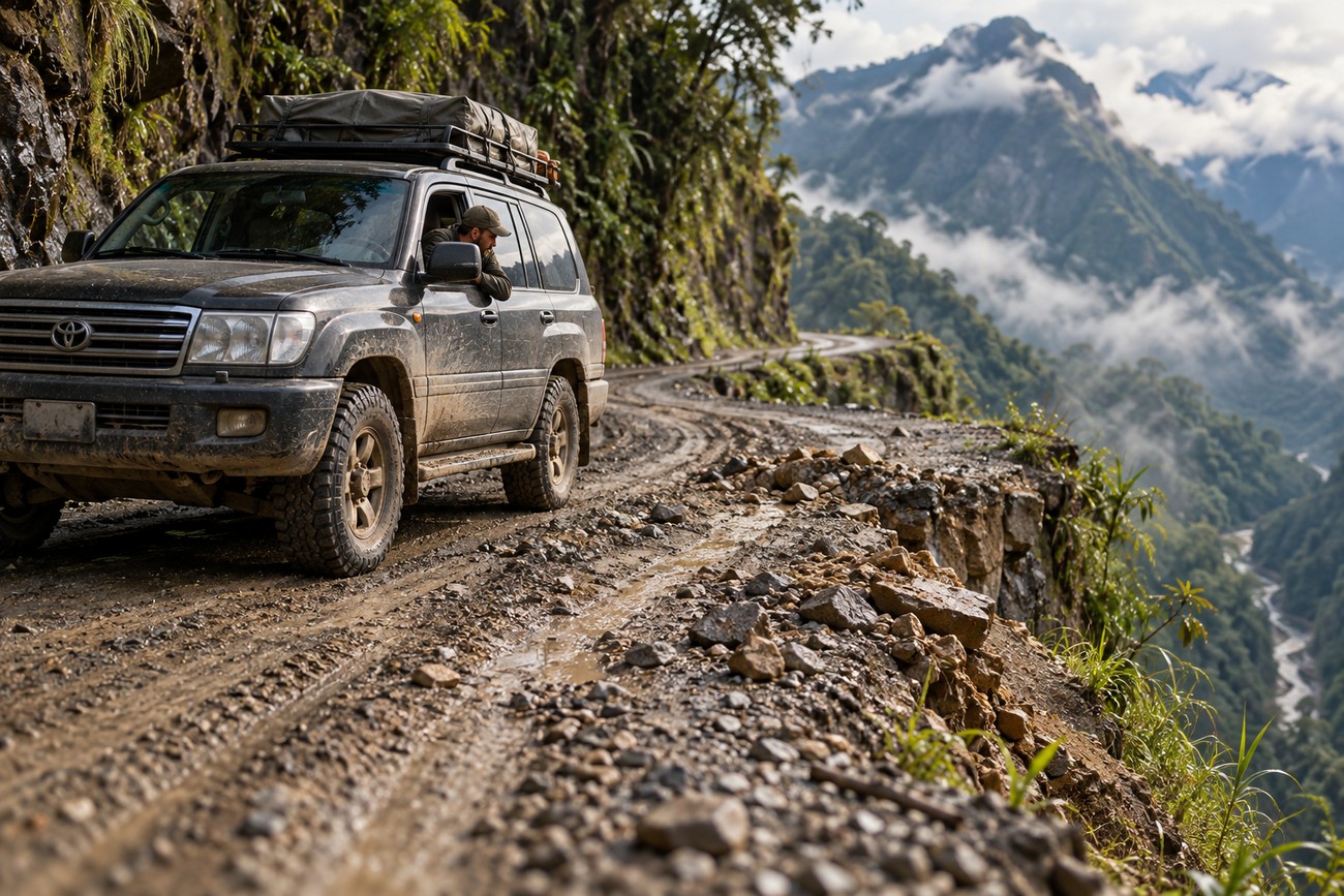
Approach every blind bend as if the usable road ends beyond the visible section. Look for the outside edge, the slope above the road, tire tracks, loose gravel, and signs of a place where vehicles have previously negotiated a passage. These details can show whether the surface will support a tire and whether there is room to wait.
Tire tracks are useful evidence, though they are not a guarantee of safety. Repeated tracks may indicate a customary line or passing area, while a broken edge, fresh mud, or scattered rock signals that the line has changed. Assess the complete approach before committing the front wheels to a narrow section.
Drivers often coordinate right-of-way through eye contact and hand signals. Use them as practical local communication, while remaining ready for another driver to misunderstand or fail to see you. If two vehicles meet without enough room, stop, communicate clearly, and move only when both drivers understand the intended maneuver.
Do not assume that a reported convoy arrangement or night restriction applies everywhere. Such procedures vary by operator and local weather conditions rather than following one universal official standard. Confirm the plan before departure, then keep the group together without allowing pressure from vehicles behind to dictate an unsafe move.
Myths That Make the Drive More Dangerous
The idea that any four-wheel-drive SUV is suitable encourages drivers to focus on drivetrain type and overlook preparation. A vehicle needs working brakes, appropriate tires, adequate clearance, a usable spare, and a driver who understands the route’s demands. Ground clearance cannot protect a vehicle from a soft edge, and traction cannot solve a visibility problem.
The main danger is not only the cliff edge. Fog, mud, loose rock, falling material, opposing traffic, wet surfaces, and brake overheating can create a crisis before the drop-off becomes visible. Treating the road as a sequence of scenic overlooks leaves too little attention for the mechanical and environmental hazards.
A Land Cruiser badge does not automatically make the trip safe. The vehicle’s weight can increase braking loads, and its size may make the road edge harder to judge from the driver’s seat. Its advantages matter when they are matched with correct gear selection, sound maintenance, suitable weather, and disciplined driving.
The old road is a genuinely demanding mountain route, even when used for a tourist excursion. Professional management reduces avoidable uncertainty, yet it cannot change the surface or weather. The responsible decision may be to delay, stop, or leave the route when the conditions exceed the vehicle’s and driver’s margins.
Frequently asked questions
The answers below separate established route information from claims that depend on local conditions or historical reputation. They also address the passenger experience, which is easy to underestimate from the driver’s seat.
Why do passengers often feel sick on a Land Cruiser tour?
Passengers commonly feel sick because the route combines repeated switchbacks, frequent braking, vibration, and a large change in altitude. The driver may be focused on the road while passengers experience the vehicle’s lateral movement and forward deceleration without controlling either one.
Sitting where the outside view is limited can make the mismatch between visual cues and body movement worse. Looking ahead through a clean window, keeping the head supported, avoiding heavy meals before the drive, and taking breaks can help. Persistent or severe symptoms warrant stopping and reassessing the journey.
What is the deadliest road in the world?
There is no universally verified official answer that establishes one road as the deadliest in the world. “Death Road” is a historical nickname associated with Bolivia’s old Yungas Road and its high accident risk, rather than a standardized global ranking.
Comparisons are difficult because roads differ in length, traffic, reporting practices, weather, and historical periods. The useful safety conclusion is local: the old Yungas Road remains a demanding route where visibility, surface conditions, vehicle preparation, and driver judgment deserve more attention than its headline.
How long is the Bolivia Death Road?
The old Yungas Road is approximately 64 km from the La Paz area toward Coroico. The exact time required varies with weather, traffic, stops, road condition, and whether the journey is part of a managed bicycle or 4×4 tour.
The distance also understates the workload. A short section can take substantial time when vehicles meet, fog reduces visibility, or rain changes the surface. The newer main route opened in 2006 and carries the principal regional traffic, so trip descriptions should specify which route they mean.
What is the Yungas Road in Bolivia?
Yungas Road is a historic mountain route descending from the La Paz area toward Coroico, from approximately 4700 m to approximately 1200 m. Its surface changes between asphalt, dirt, and gravel, with narrow sections, steep terrain, water, loose rock, and weather-related changes in grip.
The old route is commonly called Bolivia’s Death Road and is now used mainly for tourist bicycle and 4×4 tours rather than regular transport. It should be understood as a real mountain road with changing risks, not simply as a scenic attraction created for visitors.