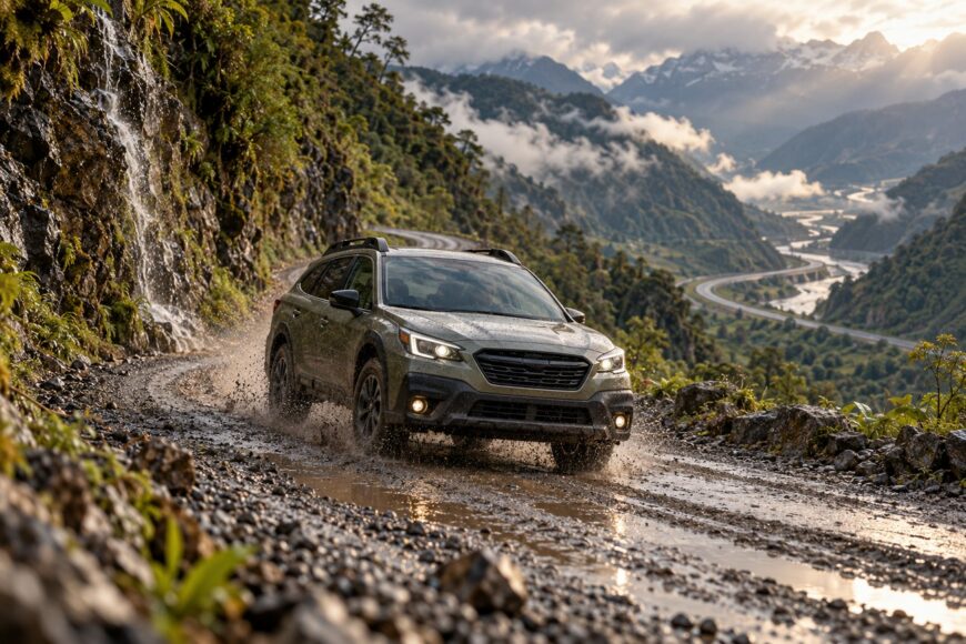
Driving a Subaru Outback across the Americas has strong appeal: it combines long-distance comfort, useful cargo space, and all-wheel drive with the ability to leave major highways for selected gravel and mountain routes. For a driver who wants to travel independently, it can be a sensible platform for a carefully chosen Pan-American itinerary.
The real decision is about route and limits. A capable road-trip vehicle can cover many sections of the network, but AWD cannot erase rough surfaces, seasonal weather, border procedures, service gaps, or the Darién Gap. The journey has to be planned as a series of road corridors, crossings, and transport links rather than as one uninterrupted drive.
That approach also makes the Outback’s strengths more useful. You can choose safer and easier alternatives, build in time for repairs and weather, and turn around before a poor road becomes a vehicle recovery problem.
- The Pan-American route is a network, not one continuous highway
- What an Outback can handle—and where to turn around
- Road conditions: when to proceed, reroute, or stop
- Prepare the car for distance, not a fantasy off-road build
- Crossing the Darién Gap means shipping the Outback
- Protect the CVT and suspension over the long haul
- Borders, daylight driving, and the changing safety picture
- Frequently asked questions
- How long would it take to drive the Pan-American Highway in an Outback?
- What should you inspect before buying a used Outback for this drive?
- What is the best vehicle to travel the Pan-American Highway?
- How safe is it to drive the Pan-American Highway?
The Pan-American route is a network, not one continuous highway
The Pan-American Highway is a road network of approximately 30,000 km from Alaska toward Tierra del Fuego, not one uniformly paved road. Its surfaces range from major highways and urban expressways to narrow mountain roads, gravel, rough tracks, and routes affected by seasonal snow or rain. The practical route depends on which corridor you select in each country.
That distinction matters in an Outback because a map line can hide a major change in difficulty. One route may use a paved highway with fuel and repair services, while a nearby alternative may include potholes, loose rock, river crossings, or a road that becomes difficult after heavy rain. A longer paved detour may protect the suspension and save days of recovery, repair, and waiting.
Weather changes the decision throughout the trip. Snow can close or complicate mountain passes, while tropical rain can damage surfaces, trigger landslides, and turn gravel into deep mud. An unpaved section is not automatically impassable, but its condition, drainage, traffic, and recent weather matter more than the label on a digital map.
The network also has an approximately 160 km break at the Darién Gap between Panama and Colombia. There is no continuous road for an ordinary car across the gap, so a complete itinerary must include a separate vehicle-transport plan. Treating that break as a minor detail is one of the quickest ways to create an unrealistic schedule.
What an Outback can handle—and where to turn around
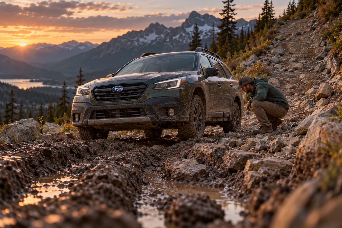
An Outback is well suited to selected Pan-American corridors. Its Symmetrical AWD can help maintain traction on loose gravel, wet pavement, and uneven surfaces, while available X-Mode can assist at low speed on some poor roads. These systems improve control, but they do not turn the car into a heavy-duty off-road vehicle.
Ground clearance, underbody exposure, and the absence of a low-range transfer case set the important limits. Deep ruts can place the floor and mechanical components on the ground, while steep, loose climbs demand more wheel torque and careful momentum than the drivetrain was designed to provide. A route that looks manageable in dry conditions may become a poor choice after rain.
Power delivery also changes with the load and elevation. Loaded climbs and overtaking can feel more demanding at Andean elevations above 3,000 m, particularly when the car is carrying passengers, camping equipment, water, and fuel. Plan passing opportunities conservatively and allow the engine to work without repeated aggressive acceleration.
Capability varies by model year, tires, suspension condition, payload, and weather. A well-maintained Outback on suitable tires may handle long gravel sections comfortably, while a worn example with a roof load and poor tires can struggle on a road that another car completes easily.
Some overlanders favor low-range 4x4s because they offer greater control and durability on difficult terrain. Outback drivers can complete selected corridors by avoiding the hardest terrain and accepting that a route change is part of responsible travel. Turn around when the road requires repeated underbody strikes, deep mud, or more traction than the car can produce without speed.
Road conditions: when to proceed, reroute, or stop
The following guide is deliberately conservative. Tires, AWD, and driving skill reduce some risks, but none of them guarantees safe passage on an unsuitable surface.
| Surface or obstacle | Specific Outback risk | Conservative decision |
|---|---|---|
| Paved but damaged road | Sudden potholes can damage tires, suspension, wheels, and exposed underbody components, especially at speed. | Proceed slowly in daylight after checking recent local conditions. Reroute if potholes cannot be seen in time or if traffic makes avoidance unsafe. |
| Maintained gravel | Loose stones can reduce braking and cornering grip, while corrugations add sustained vibration and heat to tires and suspension. | Proceed at a controlled speed with appropriate tires and a reduced load. Stop or reroute if the surface becomes unstable, flooded, or too rough for clear wheel placement. |
| Deeply rutted or muddy track | Limited clearance and no low-range transfer case increase the chance of grounding, wheelspin, bumper damage, or loss of forward progress. | Reroute before entering unless the road is known to be passable in current conditions and a safe recovery plan exists. Stop if the car begins grounding or the track has no firm line. |
| Route with no vehicle road | AWD cannot bridge a missing road. Attempting to improvise through terrain can damage the vehicle and endanger occupants. | Stop and arrange vehicle transport. The approximately 160 km Darién Gap between Panama and Colombia has no continuous road for an ordinary car. |
Road damage is often cumulative rather than dramatic. A single pothole may cause no immediate symptom, yet repeated impacts can bend a wheel, weaken a tire, or loosen suspension components. After a severe section, inspect the car before continuing to a remote area.
Local information should influence the decision. A fuel-station operator, truck driver, or local 4×4 owner may know that a bridge is out, a pass has closed, or a supposedly easy road is currently muddy. Navigation software can show the route, but it may not show its present condition.
Prepare the car for distance, not a fantasy off-road build
Start with tires suited to the actual balance of pavement, gravel, and weather on your route. Strong sidewalls and dependable wet and loose-surface grip matter more than an aggressive tread chosen for terrain you intend to avoid. Carry a properly sized spare, a way to inflate tires, and the tools needed to change a wheel safely.
Underbody protection can reduce damage from rocks and unexpected contact, particularly around vulnerable components. It should be designed for the specific Outback and installed without restricting cooling, drainage, or service access. A lift may improve clearance, but it can also alter alignment, suspension geometry, handling, and driveshaft angles; it should solve a documented problem rather than create a taller appearance.
Keep the load disciplined. Heavy items should be secured low and close to the vehicle’s center, while roof cargo should be limited because it affects handling, wind sensitivity, and fuel use. Recovery basics, including suitable straps, a shovel, gloves, and a safe way to assess attachment points, are useful only when the equipment matches the vehicle and the people using it understand its limits.
Remote stretches call for deliberate planning of fuel, water, tools, and essential spares. Before departure, inspect the cooling system, brakes, tires, suspension, battery, fluids, belts, hoses, lights, and underbody. Build a maintenance plan around the specific model year and route, with spare time for inspections rather than assuming the standard schedule will cover sustained expedition use.
Crossing the Darién Gap means shipping the Outback
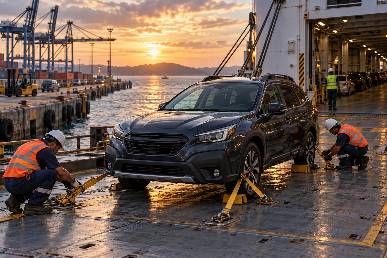
The Darién Gap is a genuine break in the road network, not a difficult trail waiting for a capable driver. The approximately 160 km gap lies between Panama and Colombia, and there is no continuous road for an ordinary car across it. An Outback cannot simply continue south by road.
The vehicle and its occupants need separately planned transport. Depending on the current options, that may involve arranging vehicle shipping or another legal transport method, while the travelers make their own crossing by an available route. Passenger arrangements and vehicle arrangements should be treated as different bookings.
Schedules, costs, ports, documentation, and import procedures can change. Confirm the current method directly with the relevant carrier, authorities, and agents before fixing departure dates or canceling accommodation. Allow time for loading, unloading, customs, delays, and possible changes in the vehicle’s arrival date.
Prepare copies of ownership documents, identification, insurance, and temporary-import paperwork, and check whether the vehicle must remain with the owner during any part of the process. The trip plan should include a fallback for a delayed vehicle, rather than assuming that passengers and car will arrive together.
Protect the CVT and suspension over the long haul
Long gravel sections, repeated pothole impacts, heavy loading, and sustained climbs change the maintenance equation. The suspension and tires absorb more punishment, while the powertrain may spend longer periods under load. Andean elevations above 3,000 m can make loaded climbs and overtaking feel more demanding, so avoid treating every pass like a normal highway run.
CVT heat concerns and limited access to Subaru-qualified service in remote areas are reported risks, not universal outcomes. They are reasons to plan carefully, monitor the car, and know where competent service is available. Do not assume that aftermarket CVT cooling is universally necessary; first check the requirements and service guidance for the specific model year.
Inspect the tires and underbody after a punishing road segment rather than waiting for a dashboard warning or the next scheduled service. A small cut, loose shield, bent wheel, or fluid seep is easier to address beside a road than after it becomes a remote recovery.
Watch for changes in vibration, steering, braking, transmission behavior, engine temperature, warning lights, and fluid levels. Schedule inspections after major rough sections, and bring forward service when the vehicle has spent extended periods in dust, heat, cold, or high load. Correct model-year guidance is more useful than a universal mileage promise.
Carry the identification details for the vehicle, suitable fluids where appropriate, and essential parts that are difficult to source on your route. A Subaru specialist may be unavailable in a remote region, and a general workshop may need clear information before diagnosing a CVT or electronic fault. Build contingency time into the itinerary for parts and repairs.
Borders, daylight driving, and the changing safety picture
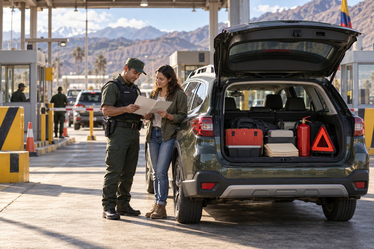
Before entering each country, verify the vehicle ownership documents, registration, driver authorization, temporary-import rules, local insurance, and mandatory safety equipment. Requirements for items such as a first-aid kit, fire extinguisher, or warning triangle vary by country and may be enforced at borders or roadside checks. Keep both digital and paper copies where practical.
Border crossings can take longer than the road distance suggests. Changing procedures, repeated vehicle inspections, and police or military checkpoints add fatigue, especially when you are also adapting to new traffic rules and road conventions. Keep documents organized, avoid rushing officials or other drivers, and leave schedule space for delays.
Daylight travel can reduce exposure to poorly marked hazards and some security risks. Potholes, animals, pedestrians, unlit vehicles, and temporary repairs are harder to identify at night, while remote roads may have fewer places to stop safely. In parts of Central and South America, recent local advice about road conditions and security is more valuable than relying on a route that was accurate months earlier.
Security conditions vary by region, city, border area, and time of day. Some travelers report concerns about theft around parked vehicles or routes affected by organized crime, but that does not make every country or every section uniformly unsafe. Use guarded or well-reviewed parking where available, keep valuables out of sight, and avoid arriving in unfamiliar towns after dark.
Leave flexibility for weather and local warnings. A road that is legally open may still be a poor choice after a landslide, flood, or recent unrest. Asking local transport operators, truck drivers, and reputable accommodation staff about the next section can reveal practical risks that a navigation app cannot.
Frequently asked questions
The answers below focus on planning, vehicle choice, preparation, and safety. Conditions vary by route, so use them as a framework rather than a fixed itinerary. Confirm current road, border, shipping, and security information before departure.
How long would it take to drive the Pan-American Highway in an Outback?
There is no reliable single duration because the Pan-American Highway is a road network of approximately 30,000 km, not one fixed itinerary. Build a time budget from the corridors you select, then add border delays, weather buffers, rest days, repair time, and the transport schedule for the Darién Gap.
A driver moving quickly on major highways will have a different schedule from one taking mountain roads, gravel alternatives, or extended stops. Treat the trip as a sequence of regional plans, with a buffer before fixed shipping, accommodation, or return-flight dates.
What should you inspect before buying a used Outback for this drive?
Start with complete service records and confirm that maintenance matches the specific model year. During an independent inspection, check CVT behavior when cold and warm, fluid leaks, warning lights, cooling-system condition, suspension noise, wheel alignment, brake wear, tire age and damage, and evidence of underbody impacts.
A road test should include smooth acceleration, reversing, low-speed maneuvering, highway cruising, and a loaded-use assessment where possible. An independent Subaru-capable technician can identify neglected maintenance more reliably than a cosmetic inspection, and a cheaper car with uncertain service history may require more preparation than its purchase price suggests.
What is the best vehicle to travel the Pan-American Highway?
The best vehicle is the one that matches your chosen corridors, payload, service plan, and tolerance for rough roads. A low-range 4×4 offers more margin on difficult terrain, while an Outback can be a practical choice for selected routes that avoid extreme off-road sections.
Reliability, parts access, tires, driver familiarity, and realistic loading often matter more than a vehicle’s adventure image. Choose the platform you can maintain and recover, rather than building a plan around roads the vehicle was never intended to cross.
How safe is it to drive the Pan-American Highway?
Safety varies substantially by country, region, road condition, weather, border area, and time of day. Daylight travel, current local advice, secure parking, conservative route selection, and a willingness to stop or reroute reduce exposure to poorly marked hazards and some security risks.
Check current government and local travel guidance before each major section. Avoid presenting the route as uniformly safe or uniformly dangerous; conditions can change over a short distance, and recent local information should guide the final decision.